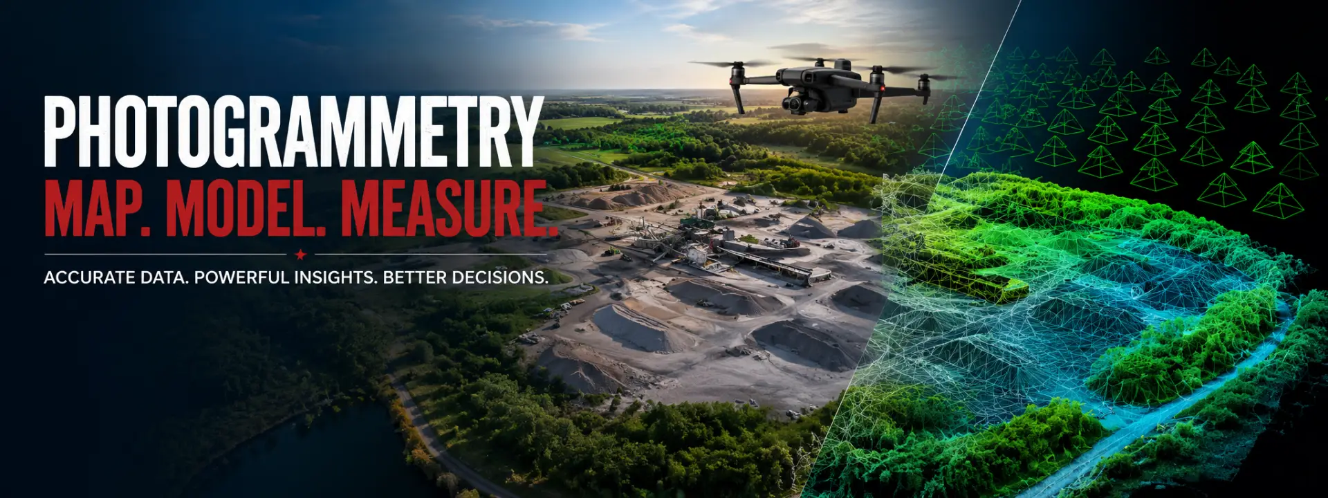
Drone photogrammetry transforms thousands of high-resolution aerial images into accurate maps, 3D models, and engineering-grade datasets. At NTX Drone Services, we provide professional photogrammetry solutions for construction, engineering, land development, agriculture, utilities, and infrastructure projects throughout North Texas. Our FAA-certified operations deliver precise aerial data that helps clients plan, measure, monitor, and manage projects with confidence.
Our photogrammetry services support a wide variety of industries requiring accurate spatial data and digital models.
We regularly provide mapping solutions for:
Construction Sites
Commercial Developments
Residential Subdivisions
Farms & Ranches
Industrial Facilities
Stockpile Volume Measurements
Roadways & Infrastructure
Utilities & Energy Projects
Environmental Monitoring
Site Planning & Land Development
Every mission is carefully planned using automated flight paths to maximize image overlap, accuracy, and data quality.
Every photogrammetry project includes professionally processed deliverables ready for engineering, planning, documentation, or GIS workflows.
Deliverables may include:
High-Resolution Orthomosaic Maps
3D Surface Models
Digital Terrain Models (DTM)
Digital Surface Models (DSM)
Point Cloud Files
CAD & GIS Compatible Deliverables
Contour Maps
Cut & Fill Analysis
Stockpile Volume Calculations
Progress Documentation
All deliverables are produced using professional photogrammetry software to ensure reliable, high-quality results that integrate seamlessly into your existing workflow.
Accurate mapping requires far more than simply flying a drone. Precision flight planning, RTK positioning, image overlap, processing expertise, and quality control all contribute to the accuracy of the final deliverables.
When you choose NTX Drone Services, you receive:
FAA Part 107 Certified Pilot
RTK-Enabled Enterprise Drone Equipment
High-Accuracy Data Collection
Automated Mapping Flight Plans
Professional Photogrammetry Processing
CAD & GIS Ready Deliverables
Fast Project Turnaround
Reliable Communication and Personalized Service
Our mission is to provide actionable data—not just aerial imagery—so you can make informed decisions with confidence.
Whether you need a detailed orthomosaic for planning, a 3D model for visualization, stockpile measurements, construction progress tracking, or engineering-grade mapping data, NTX Drone Services has the equipment and expertise to deliver accurate results.
Contact us today to discuss your project and learn how professional drone photogrammetry can save time, reduce costs, and provide the precise aerial data your project depends on.