Construction projects move quickly, and having accurate, up-to-date information is essential for staying on schedule and within budget. NTX Drone Services provides professional aerial documentation, mapping, photogrammetry, and progress monitoring that gives project managers, owners, engineers, and contractors a complete view of every stage of construction.
From pre-construction planning through final completion, our FAA-certified drone operations deliver the visual documentation and actionable data needed to make informed decisions with confidence.
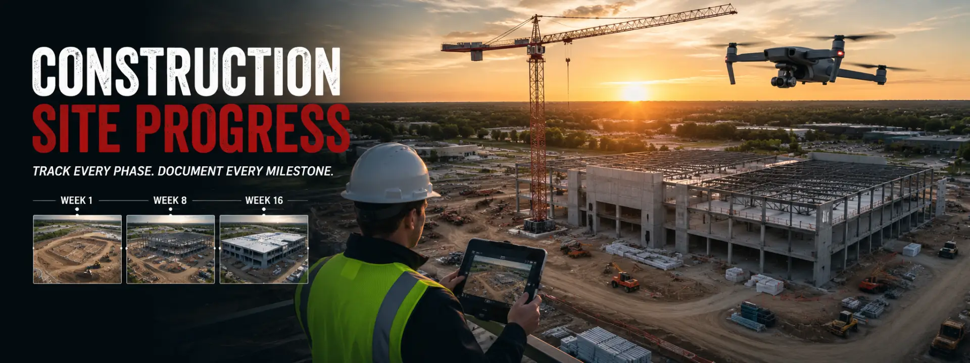
Our construction drone services are designed to improve project visibility, communication, and documentation throughout the entire construction lifecycle.
We regularly support:
Commercial Construction
Industrial Facilities
Retail Developments
Multi-Family Projects
Infrastructure Projects
Civil Engineering
Municipal Projects
Site Development
Utilities & Energy
General Contractors & Developers
Whether you’re documenting weekly progress or generating engineering-grade mapping products, our services provide valuable insight that traditional site visits simply can’t match.
Every project is customized to your specific requirements and can include a wide range of professional deliverables.
Available deliverables include:
Weekly or Monthly Progress Photos
Cinematic Progress Videos
High-Resolution Orthomosaic Maps
3D Site Models
CAD & GIS Compatible Deliverables
Digital Surface & Terrain Models
Stockpile Volume Calculations
As-Built Documentation
Thermal Imaging (when required)
Executive Progress Reports
All deliverables are professionally processed and delivered in formats that integrate seamlessly into project management, engineering, and client reporting workflows.
Construction drone services require much more than flying over a job site. Successful projects depend on consistent data collection, accurate mapping, safe flight operations, and reliable reporting.
When you partner with NTX Drone Services, you receive:
FAA Part 107 Certified Pilot
Enterprise RTK Drone Technology
Consistent Flight Planning for Repeatable Results
Professional Photogrammetry Processing
High-Resolution Aerial Photography & Video
Accurate Progress Documentation
Fast Turnaround Times
Reliable Scheduling & Communication
Our goal is to provide the aerial intelligence that helps construction teams identify issues earlier, improve coordination, reduce costly rework, and keep projects moving forward.
Whether you need weekly construction progress reports, aerial photography, orthomosaic mapping, 3D modeling, volume calculations, or complete project documentation, NTX Drone Services provides reliable drone solutions tailored to your project’s needs.
Contact us today to discuss your project and learn how professional drone services can improve project visibility, strengthen communication, and deliver the accurate documentation your team depends on.